UniMap is a free/opensource astronomy software which was designed to do the plate-solving (automated detection and sky catalog matching) for astrophotography.
Features:
- automatic detection of stars using several catalogs: SAO, HIPPARCOS, TYCHO-2, USNO B1.0, NOMAD, 2MASS, GSC
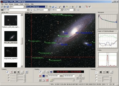
- automatic image mapping of DSO by Messier, NGC/IC, HYPERLEDA, UGC, MGC
- automatic mapping of radio sources, xray/gamma sources, supernovas, extra-solar planets, asteroids, comets and artificial earth satellites
- on click details (catalog info, measurements, spectrum, note and citations) for detected stars and galaxies. Data is mostly fetched from online source like Centre de Données astronomiques de Strasbourg, United States Naval Observatory Flagstaff Station , Centre de Recherche Astrophysique de Lyon, The Extrasolar Planets Encyclopaedia, NASA Orbital Information, NED - NASA/IPAC Extragalactic Database etc.
- access to imaging from various surveys (DSS, etc)
- draw constellations lines artwork for several cultures ( Western, Chinese, Norse, Navajo, etc)
- in image object/source search tool
- Astronomical Distances Measurement Tool - measure distances in the sky between stars and galaxies
- equatorial grid overlay
- 2D image distortion grid (test)
- 3D image distortion
- 3D image color graph
- image processing (color/filters)
- Image tagging with automatic EXIF data extraction (if available), position, target details, equipment used, weather conditions and text/record audio notes
- Can open/save images in any of the formats: FITS, JPEG, TGA, BMP, GIF, TGA, TIFF, PSD, and a number of raw formats from digital cameras such as Canon, Nikon, Pentax, FujiFilm, Minolta, Olympus.
- can print images with or without annotations
- can upload/download/browse images and analysis data associated to an online collaboration site
- customize the appearance (objects marks/units/lines/paths/etc)
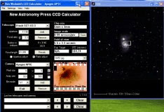
You can visualize how a telescope or a camera work together to image the sky.

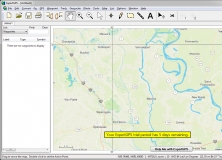
Allows you to measure quickly and accurately distances, areas and perimeters.


Comments